| djoatlarge2002EUROPE |
|
|
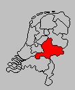
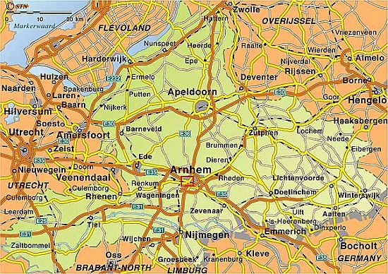
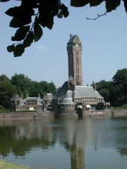
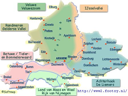
| GELDERLAND |
 |
|
|
|
 |
FRIESLAND The Netherlands |
UTRECHT The Netherlands |
 | | |
These images are unedited and unimproved.
Every image that I captured is pictured here,
and each one is presented exactly as it came from the camera, a Nikon CoolPix 990.
Full-size images, both original (most are 500 kb, 2048x1536) and improved, are available.
All content and images on this page are my copyrighted property.
|
Population Statistics for Gelderland and Achterhoek |
|
Area |
Pop (000) 1997 |
Pop (000) 2000 |
% Change |
Density (People / km²) |
| Netherlands |
15,567.0 |
15,787.0 |
+1.4 |
462 |
| Gelderland |
1,886.0 |
1,920.0 |
+1.8 |
378 |
| Achterhoek |
330.2 |
354.7 |
+7.2 |
338 |
| Arnhem |
134.7 |
138.0 |
+3.0 |
- |
| Nijmegen |
147.2 |
152.5 |
+3.6 |
- |
 |
|
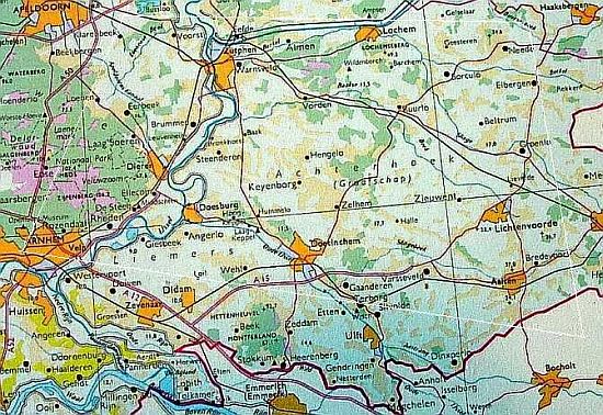
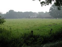
Achterhoek (translated as Back Corner) is a rural region within the Province of Gelderland in the east of The Netherlands, extending around 30 km from the German border. The region has a population of 355,000 (year 2000), around a fifth of the Provincial total (1.9 million), and a population density of 378 people per km², comparable with Kent (380) and Hampshire (340).
Apart from the substantial Gelderland towns of Arnhem and Nijmegen, which are situated to the west of Achterhoek, the region is characterized by substantial expanses of agriculture and open land, and scattered small towns and villages, which Doetinchem, Zutphen, and Winterswijk are the most significant. These provide a service function for the surrounding rural areas. --http://www.cfit.gov.uk/research/ebp/stage2/pdf/stage2f.pdf | |
|
|
Saturday 17 August 2002
DAY Hall Ge, Zutphen Ge
NIGHT Hall Ge
Region IJsselvallei - Region Achterhoek
CyclingTour, ALONG THE BANKS OF THE GELDERSE IJSSEL
Zutphen, Warnsveld, Baak, Steendaren, Bronkhorst, Brummen, Zutphen
|
Region IJsselvallei
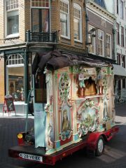
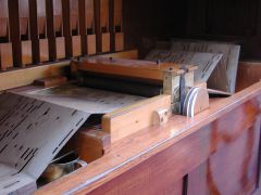
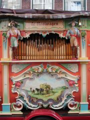
Nl Ge Zutphen. Internationaal draaiorgelverhuurbedrijf; Systeem "de Hooiwagen" ("The Hay Cart"); Carl-frei, 1985.
http://www.draaiorgelverhuur.nl |
|
Region IJsselvallei
Nl Ge Zutphen. Internationaal draaiorgelverhuurbedrijf; Systeem "de Hooiwagen" ("The Hay Cart"); Carl-frei, 1985.
http://www.draaiorgelverhuur.nl |
|
|
|
Region IJsselvallei
Nl Ge Zutphen. Internationaal draaiorgelverhuurbedrijf; Systeem "de Hooiwagen" ("The Hay Cart"); Carl-frei, 1985. http://www.draaiorgelverhuur.nl |
|
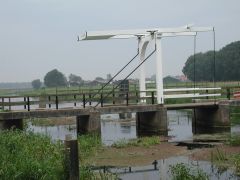
Region IJsselvallei
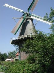
Nl Ge Warnsveld. Molen "Nooitgedacht", 1850. WNW 95 1300. |
|
|
|
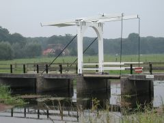
Region IJsselvallei
Nl Ge Warnsveld. Molen "Nooitgedacht", 1850. SSE 95 1300. |
|
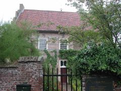
Region IJsselvallei
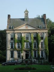
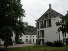
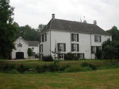
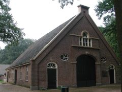
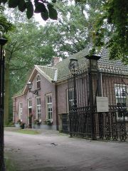
Nl Ge Warnseveld. Huis 't Velde, 16th-cen manor house, now a conference center. ENE 90 1330. |
|
|
Region IJsselvallei
Nl Gl Warnsveld. Huis 't Velde, 16th-cen manor house, now a conference center. Rear, with stables at right of frame. SE 90 1330. |
|
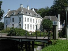
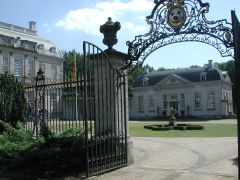
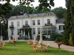
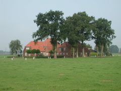
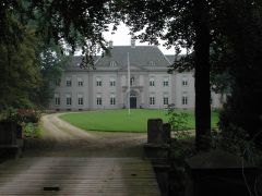
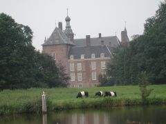
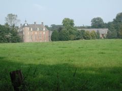
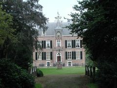
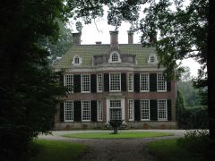
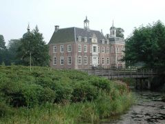
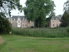
Region IJsselvallei
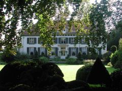
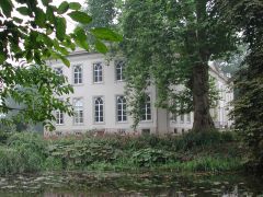
Nl Ge De Voorst. Huize de Voorst, c1700 palace with French garden. Present owner, Stichting Vrienden der Gelderse Kasteelen. E 90 1400.
Landgoed de Voorst, Het Geldersch Landschap. |
|
|
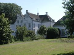
Region IJsselvallei
Nl Ge De Voorst. Huize de Voorst, c1700 palace with French garden. Present owner, Stichting Vrienden der Gelderse Kasteelen. E.
Landgoed de Voorst, Het Geldersch Landschap.
Behind me, just beyong the gate, an open BMW 2-seater pulled up while I was composing this shot. I didn't hear it. After the shot, I turned around to find the groom in the driver's seat, beside his gorgeous bride. They both were laughing. Members of the reception party, at the house, were yelling something. I don't know what--I don't speak Nederlands! |
|
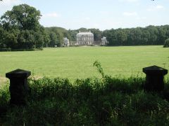
Region IJsselvallei
Nl Ge De Voorst. Huize de Voorst, c1700 palace with French garden. Present owner, Stichting Vrienden der Gelderse Kasteelen. ESE.
Landgoed de Voorst, Het Geldersch Landschap. |
|
|
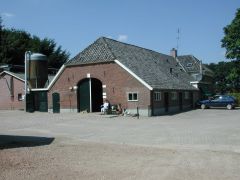
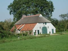
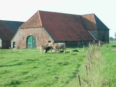
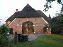
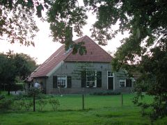
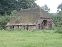
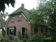
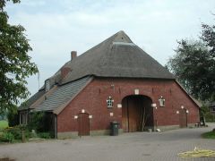
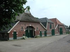
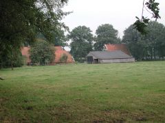
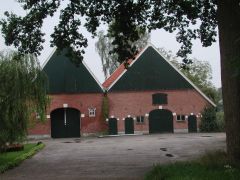
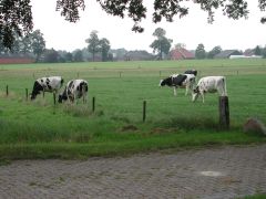
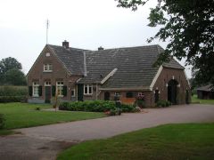
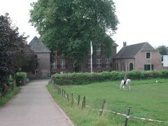
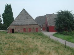
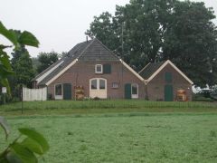
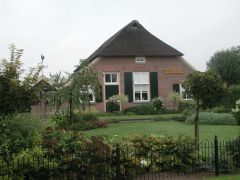
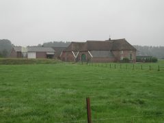
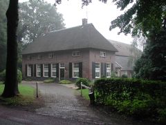
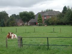
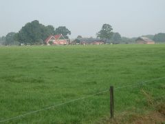
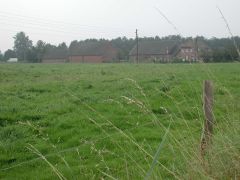
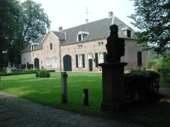
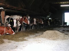
Region IJsselvallei
Nl Ge De Voorst. Farm 'Boombosch'. 1885 barn with attached house. WNW.
That's Mevrouw Huisman. Her fondest wish--"more cows". Gelders Landschap. |
|
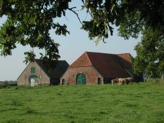
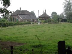
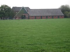
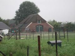
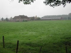
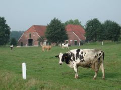
Region IJsselvallei
Nl Ge De Voorst. Farm 'Boombosch'. 1885 house with attached barn. SSW 88 1430.
That's my bike. Mevrouw Huisman (her fondest wish--"more cows") and her husband have 120 cows on 40 hectares, 7 hectares planted in corn for cow feed. Gelders Landschap. |
|
|
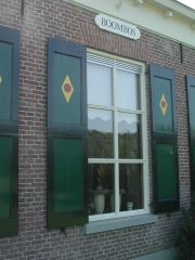
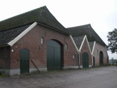
Region IJsselvallei
Nl Ge De Voorst. Farm 'Boombosch'. 1885 house with attached barn. The shutters are painted with the insignia of Gelders Landschap. |
|
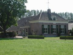
Region IJsselvallei
Nl Ge De Voorst. House 'Albemarle', on the Landgoed de Voorst, Het Geldersch Landschap. ESE 85 1500. |
|
|
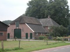
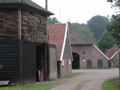
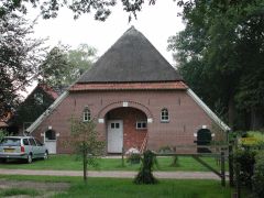
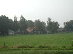
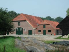
Region IJsselvallei
Nl Ge De Voorst. Farm. WNW 87 1500. |
|
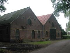
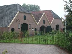
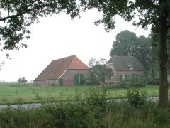
Region IJsselvallei
Nl Ge Zutphen. Farm. WSW 100 1530. |
|
|
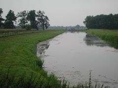
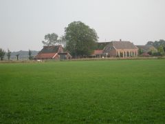
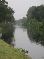
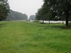
Region IJsselvallei
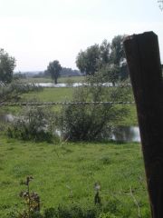
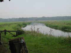
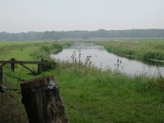
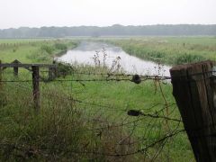
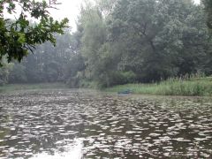
Nl Ge. View to Zutphen along Gelderse IJssel (River). N 90 1600. |
|
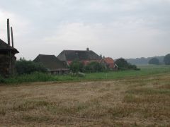
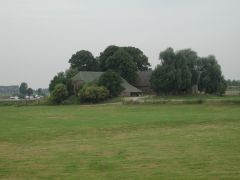
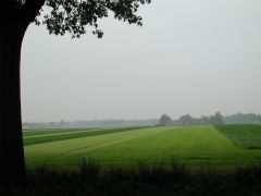
Region IJsselvallei
Nl Ge. Farm between Zutphen and Baak. ENE 90 1600. |
|
|
Region IJsselvallei
Nl Ge. Gelderse IJssel (River) between Zutphen and Baak. WSW. |
|
Region IJsselvallei
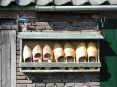
Nl Ge. Klompen on exterior of barn in Baak. After use, wooden shoes are typically put away on end, so that any rain water which might fall on them cannot accumulate inside. |
|
|
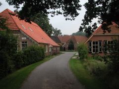
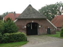
Region IJsselvallei
Nl Ge Baak. Barn 'Boelengoed' in village Baak. SSE 93 1645. |
|
Region IJsselvallei
Nl Ge Brummen. The historic country place Spaensweerd, dating from the 17th-century, situated in the water-meadows of the IJssel, between Bronkhorst and Brummen, Bronkhorsterweg 18. SW 85 1745. Now a Bed&Breakfast Inn.
http://www.unistoric.org/uehha/index.jsp |
|
|
Region IJsselvallei
Nl Ge Brummen. Farm 'De Bronkhorst Hoeve'. NNE 87 1800. |
|
Region IJsselvallei
Nl Ge Brummen. Farmhouse in Cortenoever. |
|
|
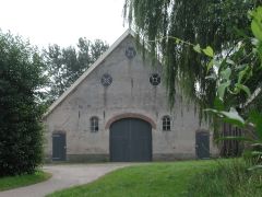
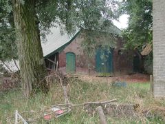
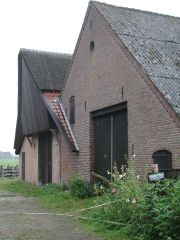
Region IJsselvallei
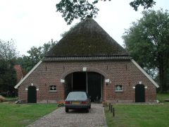
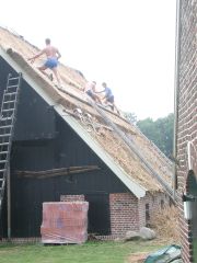
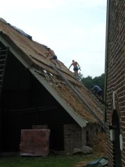
Nl Ge Zutphen. Barn, west of town. NNE 95 1830. |
|
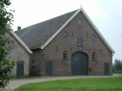
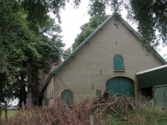
Region IJsselvallei
Nl Ge Zutphen. Barn, west of town. |
|
|
Region IJsselvallei
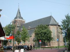
Nl Ge Zutphen. Drogenapstoren, one of the town's three remaining defensive towers. SSE 80 1930. |
|
Region IJsselvallei
Nl Ge Zutphen. Oude Bornhof, a courtyard surrounded by homes for the town's old people. W 80 1930. |
|
|
Region IJsselvallei
Nl Ge. Farmhouse (1921) in Epserbos (Epse). SSE 83 2015.
N B North of Eefde, before crossing the border into Provincie Overijssel, the IJssel flows through a typical Achterhoek landscape of water and river meadows, country estates, woods and small areas of heathland. |
|
Region IJsselvallei
Nl Ge Eefde. Farmhouse. SW 87 2030.
N B North of Eefde, before crossing the border into Provincie Overijssel, the IJssel flows through a typical Achterhoek landscape of water and river meadows, country estates, woods and small areas of heathland. |
|
Sunday 18 August 2002
DAY Hall Ge, Hoenderloo Ge (East entrance, Nationaal Park De Hoge Veluwe)
NIGHT Hall Ge
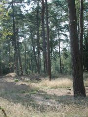
Region Veluwe
CyclingTour, AROUND HOGE VELUWE NATIONAL PARK
|
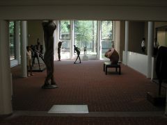
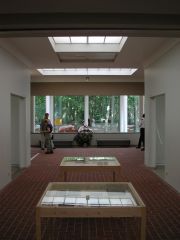
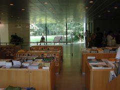
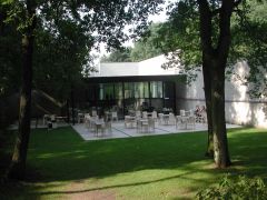
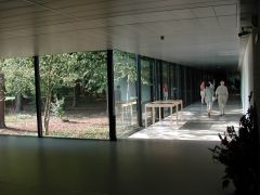
Nl Ge Otterlo. Hoge Veluwe National Park. Kröller-Müller Museum (1938, Henry van de Velde; 1977, Wim Quist), interior. |
|
Nl Ge Otterlo. Hoge Veluwe National Park. Kröller-Müller Museum (1938, Henry van de Velde; 1977, Wim Quist), interior. |
|
|
Nl Ge Otterlo. Hoge Veluwe National Park. Kröller-Müller Museum (1938, Henry van de Velde; 1977, Wim Quist), interior. |
|
Nl Ge Otterlo. Hoge Veluwe National Park. Kröller-Müller Museum (1938, Henry van de Velde; 1977, Wim Quist), interior. |
|
|
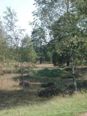
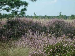
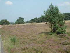
Nl Ge Otterlo. Hoge Veluwe National Park. Heide (Heather). |
|
Nl Ge Otterlo. Hoge Veluwe National Park. |
|
|
Nl Ge Otterlo. Hoge Veluwe National Park. |
|
Nl Ge Otterlo. Hoge Veluwe National Park. |
|
|
Nl Ge Otterlo. Hoge Veluwe National Park. |
|
Nl Ge Otterlo. Hoge Veluwe National Park. |
|
|
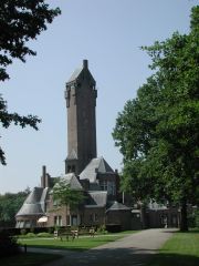
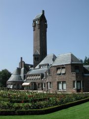
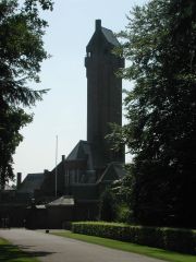
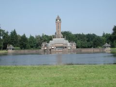
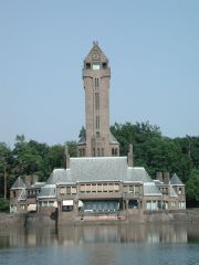
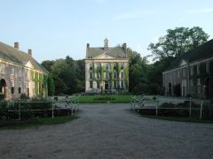
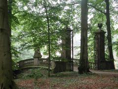
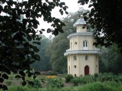
Nl Ge Otterlo. Hoge Veluwe National Park. Jachthuis 'St Hubertus' hunting lodge (built 1914 by H P Berlage for the Kröller-Müller family). WSW 83 1330. |
|
Nl Ge Otterlo. Hoge Veluwe National Park. Jachthuis 'St Hubertus' hunting lodge (built 1914 by H P Berlage for the Kröller-Müller family). W 83 1330. |
|
|
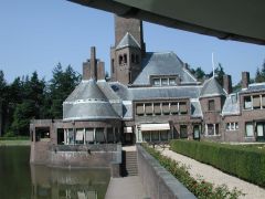
Nl Ge Otterlo. Hoge Veluwe National Park. Jachthuis 'St Hubertus' hunting lodge (built 1914 by H P Berlage for the Kröller-Müller family). NNW. |
|
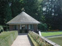
Nl Ge Otterlo. Hoge Veluwe National Park. Jachthuis 'St Hubertus' hunting lodge (built 1914 by H P Berlage for the Kröller-Müller family). Teahouse. SE. |
|
|
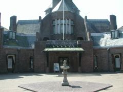
Nl Ge Otterlo. Hoge Veluwe National Park. Jachthuis 'St Hubertus' hunting lodge (built 1914 by H P Berlage for the Kröller-Müller family). Front entrance. SW. |
|
Nl Ge Otterlo. Hoge Veluwe National Park. Jachthuis 'St Hubertus' hunting lodge (built 1914 by H P Berlage for the Kröller-Müller family). East entrance gate detail. NNW 93 1345. |
|
|
Nl Ge Otterlo. Hoge Veluwe National Park. Jachthuis 'St Hubertus' hunting lodge (built 1914 by H P Berlage for the Kröller-Müller family). SSW. |
|
Nl Ge Otterlo. Hoge Veluwe National Park. Jachthuis 'St Hubertus' hunting lodge (built 1914 by H P Berlage for the Kröller-Müller family). SSW. |
|
|
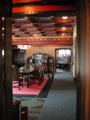
Nl Ge Otterlo. Hoge Veluwe National Park. Jachthuis 'St Hubertus' hunting lodge (built 1914 by H P Berlage for the Kröller-Müller family), interior. Dining Room, with Library beyond. |
|
Nl Ge Otterlo. Hoge Veluwe National Park. Jachthuis 'St Hubertus' hunting lodge (built 1914 by H P Berlage for the Kröller-Müller family). SSE 86 1500. |
|
|
Nl Ge Otterlo. Hoge Veluwe National Park. Jachthuis 'St Hubertus' hunting lodge (built 1914 by H P Berlage for the Kröller-Müller family). NE. |
|
Nl Ge Otterlo. Hoge Veluwe National Park. Jachthuis 'St Hubertus' hunting lodge (built 1914 by H P Berlage for the Kröller-Müller family). NE. |
|
|
Nl Ge Otterlo. Hoge Veluwe National Park. Jachthuis 'St Hubertus' hunting lodge (built 1914 by H P Berlage for the Kröller-Müller family). |
|
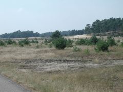
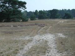
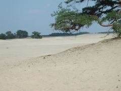
Nl Ge Otterlo. Hoge Veluwe National Park. "Otterlose Zand" area. |
|
|
Nl Ge Otterlo. Hoge Veluwe National Park. "Otterlose Zand" area. |
|
Nl Ge Otterlo. Hoge Veluwe National Park. "Otterlose Zand" area. |
|
|
Nl Ge Otterlo. Hoge Veluwe National Park. "Otterlose Zand" area. |
|
Nl Ge Otterlo. Hoge Veluwe National Park. "Otterlose Zand" area. |
|
|
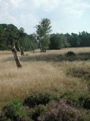
Nl Ge Otterlo. Hoge Veluwe National Park. "De Hoge Veluwe" area. |
|
Nl Ge Otterlo. Hoge Veluwe National Park. "De Hoge Veluwe" area. |
|
|
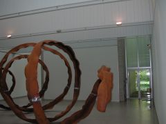
Nl Ge Otterlo. Hoge Veluwe National Park. Kröller-Müller Museum (1938, Henry van de Velde; 1977, Wim Quist), interior. Sculpture Beeld 4 (1997-2001) by R W van de Wint. |
|
Nl Ge Otterlo. Hoge Veluwe National Park. Kröller-Müller Museum (1938, Henry van de Velde; 1977, Wim Quist), exterior. |
|
|
Nl Ge Otterlo. Hoge Veluwe National Park. Kröller-Müller Museum (1938, Henry van de Velde; 1977, Wim Quist), interior. 1700, closing time. |
|
|
|
|
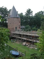
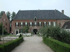
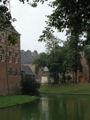
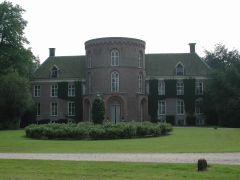
Region IJsselvallei
Nl Ge Loenen. Huis Ter Horst. Kasteel, 1557; coachhouse and stalls, 1792. SSE 85 1845. |
|
Region IJsselvallei
Nl Ge Loenen. Huis Ter Horst. Kasteel, 1557; coachhouse and stalls, 1792. SSE 85 1845. |
|
|
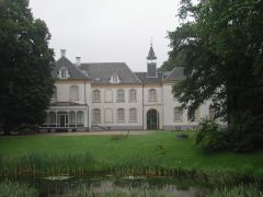
Region IJsselvallei
Nl Ge Eerbeek. Huis Te Eerbeek. NNW 87 1945.
The estate and former castle, dating from the 14th century, was originally the property of the Lords of Bronckhorst and served as a hunting lodge. It was totally renovated in 1872, taking on the appearance it has today. In 1947 the building became the property of the foundation "Het Gelder Landschap". Today, the estate is operated as a hotel and conference center.
http://www.hhte.com/default.html |
|
Region IJsselvallei
Nl Ge. Bridge over Apeldoornse Kanaal, at Hallseweg, between Hall and Eerbeek. WNW 84 2000. |
|
Monday 19 August 2002
DAY Hall Ge, Almen Ge, De Ehze Ge, Velhorst Ge, Lochem Ge, Gelselaar Ge, Geesteren Ge, Eibergen Ge, Harlo Ge, Borculo Ge, Beekvliet Ge, Barchem Ge
NIGHT Hall Ge
Region Achterhoek
DrivingTour, THE RIVER BERKEL
Almen, Lochem, Borculo, Gelselaar, Geesteren, Neede, Hoonte, Haarlo, Eibergen
|
Nl Ge Almen. Bridge over Twentekanaal. ENE 80 0930. |
|
Nl Ge Almen. Bridge over Twentekanaal SSE 80 0930. |
|
|
Nl Ge (Gorssel). Estate Landgoed 'De Ehze', entrance gate. ENE 74 0930.
Near Almen are situated two beautiful areas of wooded land--Oude Berkenroede and De Ehze. Additionally, there is 't Walien, an enormous area of natural countryside comprising three large estates. Among them, Veldhorst has a splendid 18th-cen house. |
|
Nl Ge (Gorssel). Estate Landgoed 'De Ehze', landhuis. N 74 0930. |
|
|
Nl Ge Almen. Estate Landgoed Ehzerwold (1914 mainhouse, originally a sanitarium and hospital; 1997, thoroughly renovated). Today a Hotel and Conference Center. SSE. |
|
Nl Ge Almen. River Berkel. ESE 75 1000. |
|
|
Nl Ge Almen. River Berkel. ESE 75 1000. |
|
Nl Ge Almen. River Berkel. ESE 75 1000. |
|
|
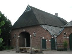
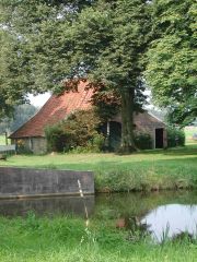
Nl Ge Almen. 1916 barn and attached farmhouse. ESE |
|
Nl Ge (Lochem). Velhorst (Vereniging Natuurmonumenten). |
|
|
Nl Ge (Lochem). Velhorst (Vereniging Natuurmonumenten). |
|
Nl Ge (Lochem). Velhorst (Vereniging Natuurmonumenten). |
|
|
Nl Ge (Lochem). Velhorst (Vereniging Natuurmonumenten). |
|
Nl Ge (Lochem). Velhorst (Vereniging Natuurmonumenten). |
|
|
Nl Ge (Lochem). Velhorst (Vereniging Natuurmonumenten). |
|
Nl Ge (Lochem). Velhorst (Vereniging Natuurmonumenten). |
|
|
Nl Ge (Lochem). Velhorst (Vereniging Natuurmonumenten). |
|
Nl Ge (Lochem). Velhorst (Vereniging Natuurmonumenten). |
|
|
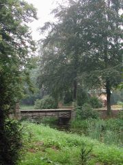
Nl Ge (Lochem). Velhorst (Vereniging Natuurmonumenten). Bridge over the River Berkel. Waterschap Rijn en IJssel; Waterschap van de Berkel. |
|
Nl Ge (Lochem). Velhorst (Vereniging Natuurmonumenten). Bridge over the River Berkel. Waterschap Rijn en IJssel; Waterschap van de Berkel. |
|
|
Nl Ge (Lochem). Velhorst (Vereniging Natuurmonumenten). Bridge over the River Berkel. Waterschap Rijn en IJssel; Waterschap van de Berkel. |
|
Nl Ge (Lochem). Velhorst (Vereniging Natuurmonumenten). |
|
|
Nl Ge (Lochem). Velhorst (Vereniging Natuurmonumenten). |
|
Nl Ge (Lochem). Velhorst (Vereniging Natuurmonumenten). |
|
|
Nl Ge (Lochem). |
|
Nl Ge (Lochem). |
|
|
Nl Ge (Lochem). |
|
Nl Ge (Lochem). |
|
|
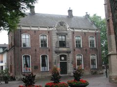
Nl Ge (Lochem) Lochem. Town Hall. NW 73 1245.
Lochem, with it's 14th-cen hall church, Sint-Gugulakerk (or Grote Kerk), and replacement (17th-cen) Renaissance-style Town Hall, is a prosperous town set in beautiful surroundings, with an active industry and a pleasant center. To the north are 23 large country estates, including Ampsen with it's 16th-cen Huis Ampsen and 18th-cen Huis Verwolde. Natural areas are Lochemse Berg and Kalenberg (where there is the Witte Wievenkoele old loam quarry--nighttime trips arranged in the tourist season). |
|
Nl Ge Gelselaar. House at pannenkoekenboerderij Erve Brooks / museumboerderij Erve Brooks Niehof. NNW 86 1415. |
|
|
Nl Ge Gelselaar. Pannenkoekenboerderij Erve Brooks / museumboerderij Erve Brooks Niehof. Three attached barns, 1895, 1921, 1912. |
|
Nl Ge Gelselaar. Pannenkoekenboerderij Erve Brooks / museumboerderij Erve Brooks Niehof. One of three attached barns, 1895. |
|
|
Nl Ge Gelselaar. House at pannenkoekenboerderij Erve Brooks / museumboerderij Erve Brooks Niehof. |
|
Nl Ge Gelselaar. 1911 barn. |
|
|
Nl Ge Gelselaar. Three attached barns, 1882, ?, 1930. |
|
Nl Ge Geesteren. Historic house 'Wanninkhof' (Het Geldersch Landschap). |
|
|
Nl Ge Geesteren. 1865 house adjacent to historic house 'Wanninkhof' (Het Geldersch Landschap). |
|
Nl Ge Geesteren. Historic house 'Wanninkhof' (Het Geldersch Landschap). |
|
|
Nl Ge Geesteren. Historic house 'Wanninkhof' (Het Geldersch Landschap). |
|
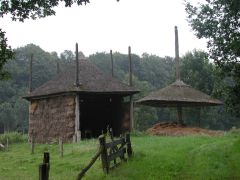
Nl Ge Geesteren. Korenmolen 'De Ster'. |
|
|
Nl Ge Geesteren. Korenmolen 'De Ster'. |
|
Nl Ge Eibergen. Farm. |
|
|
Nl Ge Eibergen. Farm. |
|
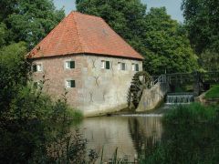
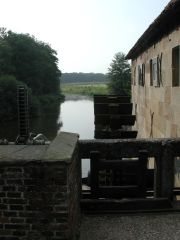
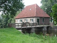
Nl Ge Eibergen. 1748 Mallemse Watermolen and Muldershuis, situated across a short canal beside the river Berkel. |
|
|
Nl Ge Eibergen. 1748 Mallemse Watermolen and Muldershuis, situated across a short canal beside the river Berkel. |
|
Nl Ge Eibergen. Barn near Mallemse Watermolen. |
|
|
Nl Ge Eibergen. 1748 Mallemse Watermolen and Muldershuis, situated across a short canal beside the river Berkel. |
|
Nl Ge Eibergen. 1748 Mallemse Watermolen and Muldershuis, situated across a short canal beside the river Berkel. |
|
|
Nl Ge Eibergen. 1748 Mallemse Watermolen and Muldershuis, situated across a short canal beside the river Berkel. |
|
Nl Ge Eibergen. House near Mallemse Watermolen. |
|
|
Nl Ge Eibergen. Double-barn. |
|
Nl Ge Haarlo. Barn. |
|
|
Nl Ge Haarlo. Farm scene. |
|
Nl Ge Borculo. 1882 barn, converted to a house. |
|
|
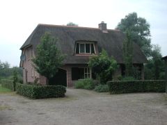
Nl Ge Barchem. 1928 farmhouse with attached barn. |
|
Nl Ge (Borculo). Canal to river Berkel at Beekvliet. NNW 80 1915. |
|
|
Nl Ge (Borculo). Manor house by canal to river Berkel at Beekvliet. ENE. |
|
Nl Ge (Borculo). Beelvliet area. |
|
|
Nl Ge (Borculo). Beelvliet area. |
|
Nl Ge (Borculo). Beelvliet area. |
|
|
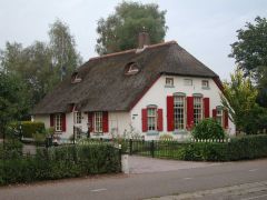
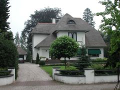
Nl Ge Barchem. A little white farmhouse. |
|
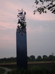
Region IJsselvallei
Nl Ge Hall. Steel sculpture of wildlife. |
|
Tuesday 20 August 2002
DAY Hall Ge, Giesbeek Ge, Duiven Ge, Loo Ge, Herwen Ge, Zevenaar Ge, Babberich Ge, Tolkamer Ge
NIGHT Hall Ge
Region De Liemers
DrivingTour, BETWEEN THE RHINE AND THE OUDE IJSSEL
Beek, Didam, Wehl, Duiven, Zevenaar, Herwen, Tolkamer
|
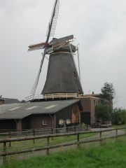
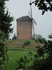
Nl Ge Giesbeek. 1888-1982 windmill 'De Hoop'. |
|
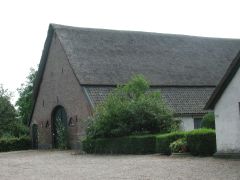
Nl Ge Duiven. Barn. |
|
|
Nl Ge Loo. One of two adjoining barns. |
|
Nl Ge Loo. One of two adjoining barns. |
|
|
Nl Ge Loo. 1525 manorial farm 'De Looward'. NNW 79 1245. |
|
Nl Ge Loo. 1525 manorial farm 'De Looward'. ENE. |
|
|
Nl Ge Loo. 1525 manorial farm 'De Looward'. SSE. |
|
Nl Ge Loo. 1525 manorial farm 'De Looward'. SSW. |
|
|
Nl Ge Loo. 1525 manorial farm 'De Looward'. WSW. |
|
Nl Ge Loo. 1525 manorial farm 'De Looward'. Pannerdens Canal in background. WSW. |
|
|
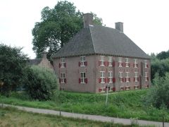
Nl Ge Herwen. 1652 Huis Aerdt. Walraaf van Steenhuys. WSW 86 1415. |
|
Nl Ge Herwen. 1652 Huis Aerdt. Walraaf van Steenhuys. Farm buildings. ENE. |
|
|
Nl Ge Herwen. 1652 Huis Aerdt. Walraaf van Steenhuys. SE. |
|
Nl Ge Zevenaar. Huise Sevenaer. ENE 77 1700. Residence of Duke van Nispen, a poor duke, with some authority over the lands from Sevenaer to Pannarden. |
|
|
Nl Ge Zevenaar. Huise Sevenaer. Residence of Duke van Nispen, a poor duke, with some authority over the lands from Sevenaer to Pannarden. |
|
Nl Ge Babberich. 1363/1380 Kasteel 'Halsaf'* (or 1785 'Huize Babberich'). ESE.
*Literal translation "Neck-off".
http://www.halsaf.nl |
|
|
Nl Ge Babberich. 1363/1380 Kasteel 'Halsaf'* (or 1785 'Huize Babberich'). ESE.
*Literal translation "Neck-off".
http://www.halsaf.nl |
|
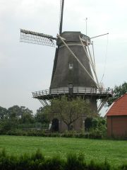
Nl Ge Zevenaar. Molen 'De Hoop'. WNW. |
|
|
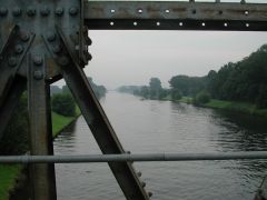
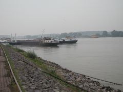
Nl Ge Tolkamer. Europakade, on the Rhine (Rhein) River, where the Rhine enters Nederland from Germany. SSE 73 1915. |
|
|
|
Wednesday 21 August 2002
DAY Hall Ge, Bronkhorst Ge, Baak Ge, Wichmond Ge, Vorden Ge, Arnhem Ge
NIGHT Hall Ge
rain all day
|
Region IJsselvallei
Nl Ge Bronkhorst. Three attached, converted barns. SSE 69 1000. |
|
Region IJsselvallei
Nl Ge Bronkhorst. Double barn. NNE. |
|
|
Region IJsselvallei
Nl Ge Bronkhorst. 1633 house ''t Hooge Huys'. NNE. |
|
Region IJsselvallei
Nl Ge Bronkhorst. House near Bronkhorst. |
|
|
Region IJsselvallei
Nl Ge Bronkhorst. House near Bronkhorst, 'Vilderskûte'. |
|
Region IJsselvallei
Nl Ge Bronkhorst. Barn near Bronkhorst. |
|
|
Region IJsselvallei
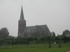
Nl Ge Baak. Church. WNW 70 1045. |
|
Region IJsselvallei
Nl Ge Baak. Huis te Baak. NNE. |
|
|
Region Achterhoek
Nl Ge Wichmond. Farm near Wichmond. ENE. |
|
Region Achterhoek
Nl Ge Wichmond. Farm near Wichmond. NNW. |
|
|
Region Achterhoek
Nl Ge Wichmond. Triple-barn 'De Kieffshuerne' near Wichmond (3rd keystone reads '1806'). |
|
Region Achterhoek
Nl Ge Wichmond. Farmhouse and barn near Wichmond. |
|
|
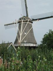
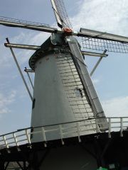
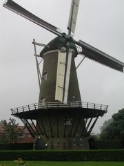
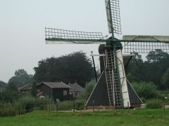
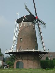
Region Achterhoek
Nl Ge Vorden. Molen. SE. |
|
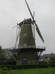
Region Achterhoek
Nl Ge Vorden. Molen. S. |
|
|
Region IJsselvallei
Nl Ge. Between Dieren and Eerbeek. Apeldoorns Kanaal. NNW 78 1830. |
|
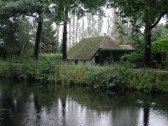
Region IJsselvallei
Nl Ge. Near Hall. Cottage along Apeldoorns Kanaal. NNE. |
|
Thursday 22 August 2002
DAY Hall Ge, Doetinchem Ge, Zelhem Ge
NIGHT Hall Ge
|
Region Achterhoek
Nl Ge IJzevoord. Nijland Family farm. |
|
Region Achterhoek
Nl Ge Doetinchem. |
|
|
Region IJsselvallei
Nl Ge Hall. N I V O N. |
|
Region IJsselvallei
Nl Ge Hall. N I V O N. |
|
|
Region IJsselvallei
Nl Ge Hall. N I V O N. |
|
Region IJsselvallei
Nl Ge Hall. N I V O N. |
|
|
Region IJsselvallei
Nl Ge Hall. N I V O N. |
|
|
|
Friday 23 August 2002
See UTRECHT The Netherlands
Saturday 24 August 2002
See NORTH-HOLLAND The Netherlands
Sunday 25 August 2002
See UTRECHT The Netherlands
See FLEVOLAND The Netherlands
See OVERIJSSEL The Netherlands
Monday 26 August 2002
See OVERIJSSEL The Netherlands
Tuesday 27 August 2002
DAY Bornerbroek Ov, Eibergen Ge, Dinxperlo Ge, Megchelen Ge, 's Heerenberg Ge, Zeddam Ge, Terborg Ge, Laag Keppel Ge
NIGHT Bornerbroek Ov
Continued from OVERIJSSEL The Netherlands
|
Region Achterhoek
Nl Ge Eibergen. Farm along N18 near Eibergen. |
|
Region Achterhoek
Nl Ge Eibergen. Neighboring farm along N18 near Eibergen. |
|
|
Region Achterhoek
Nl Ge Eibergen. Farm along N18 near Eibergen. |
|
Region Achterhoek
Nl Ge Eibergen. Another farm along N18 near Eibergen. |
|
|
Region Achterhoek
Nl Ge Eibergen. Erve Roosink, along N18 near Eibergen. |
|
Region Achterhoek
Nl Ge Eibergen. Erve Zweerink, along N18 near Eibergen. "Hey... wha' choo want?" |
|
|
Region Achterhoek
Nl Ge Aalten. Farm along N313 near Aalten. |
|
Region Achterhoek
Nl Ge IJzerlo. Manege 'De Achterhoek' and Boerderij ''t Hoftijzer', pensionboerderij, minicamping, & manege. Landelijke Rijvereniging en Ponyclub. |
|
Region Achterhoek
DrivingTour, ALONG THE BANKS OF THE OUDE IJSSEL
Dinxperlo, Megchelen, Ulft, Terborg, Gaanderen, Langerak, Laag Keppel
Region De Liemers
DrivingTour, BETWEEN THE RHINE AND THE OUDE IJSSEL (cont'd from Tue 20 Aug)
's Heerenberg (Montferland), Zeddam
|
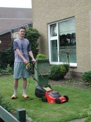
Region Achterhoek
Nl Ge Dinxperlo. Lawn-mowing-man.
Traveling in the south-eastern part of Province GELDERLAND, you find little Dinxperlo, frontier town with German Suderwick (WESTFALIA). From the end of WW II in 1945 until 1963 Suderwick as well was part of Holland; in August 1963 (following the Dutch-German Treaty) Suderwick became German again and the old borderline was re-established. In 1996 customs control/check points and border gates disappeared. Just cross the street and you are in a different country speaking a different language.
The miniscule area of Germany through which I traveled this day appeared more 'grey' and unkempt than its Dutch neighbor.
Neder-saxische
Twentse
Achterhoekse
The dialect spoken in Munster (Germany) |
|
Region Achterhoek
Nl Ge Dinxperlo. House. |
|
|
Region Achterhoek
Nl Ge Dinxperlo. House. |
|
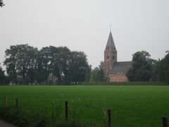
Region Achterhoek
Nl Ge Dinxperlo. 15th-cen Christian Reformed Church, 'Liborus'. Originally Roman Catholic. WSW 73 1230. |
|
|
Region Achterhoek
Nl Ge Dinxperlo. 15th-cen Christian Reformed Church, 'Liborus'. Originally Roman Catholic. ENE 73 1230. |
|
De Anholt. Farm along Route 909 near Anholt (Germany). |
|
|
De Anholt. Neighboring farm along Route 909 near Anholt (Germany). |
|
Region Achterhoek
Nl Ge Megchelen. 'Huis Landfort', first mentioned 1434. Beautiful country estate. Het Geldersch Landschap. SE 74 1345. |
|
|
Region Achterhoek
Nl Ge Megchelen. 'Huis Landfort', first mentioned 1434. Beautiful country estate. Het Geldersch Landschap. Bridge over moat. |
|
Region Achterhoek
Nl Ge Megchelen. 'Huis Landfort', first mentioned 1434. Beautiful country estate. Het Geldersch Landschap. Bridge over moat. |
|
|
Region Achterhoek
Nl Ge Megchelen. 'Huis Landfort', first mentioned 1434. Beautiful country estate. Het Geldersch Landschap. Garden folly. WSW 74 1400. |
|
Region Achterhoek
Nl Ge Megchelen. 'Huis Landfort', first mentioned 1434. Beautiful country estate. Het Geldersch Landschap. Moat. SSE. |
|
|
Region Achterhoek
Nl Ge Megchelen. 'Huis Landfort', first mentioned 1434. Beautiful country estate. Het Geldersch Landschap. SSW. |
|
Region Achterhoek
Nl Ge Megchelen. 'Huis Landfort', first mentioned 1434. Beautiful country estate. Het Geldersch Landschap. Pasture and drainage ditch. |
|
|
Region De Liemers
Nl Ge 's-Heerenberg. Restaurant menu--diverse sandwiches, coffee with cake, etc. |
|
Region De Liemers
Nl Ge 's-Heerenberg. 1531 late-Gothic Raadhuis (Town Hall). SSW. |
|
|
Region De Liemers
Nl Ge 's-Heerenberg. 15th-cen 'Oude Grafelijk Munt' Old County Mint. Formerly 'Bergs Muntmeesterhuis' County Berg Mint Master's House. "Moneta Com. Montensis"; "Renovata MCMLXXIV". NNE. |
|
Region De Liemers
Nl Ge 's-Heerenberg. Huize Berg. SE 78 1515.
http://www.heemkunde.nl/
http://www.bergh.nl/ |
|
|
Region De Liemers
Nl Ge 's-Heerenberg. Huize Berg. WNW. |
|
Region De Liemers
Nl Ge 's-Heerenberg. Huize Berg. NNW. |
|
|
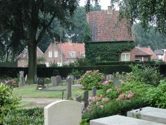
Region De Liemers
Nl Ge 's-Heerenberg. Huize Berg. Ned Hervormde Kerk cemetery. |
|
Region De Liemers
Nl Ge 's-Heerenberg. Huize Berg. WNW. |
|
|
Region De Liemers
Nl Ge 's-Heerenberg. Huize Berg. NW. |
|
Region De Liemers
Nl Ge 's-Heerenberg. 1550 Boetzelaersborg. NW. |
|
|
Region De Liemers
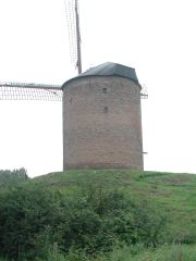
Nl Ge Zeddam. 'No-name' Mill, oldest in Nederland. 1441 Grafelijk Torenmolen ("Count van den Bergh's mill"); type beltmolen. Wind-driven flour mill. Vlucht 26.49 m; wiekvorm Oud-Hollands. SSW 83 1630.
http://www.torenmolen.nl/ |
|
Region De Liemers
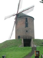
Nl Ge Zeddam. 'No-name' Mill, oldest in Nederland. 1441 Grafelijk Torenmolen ("Count van den Bergh's mill"); type beltmolen. Wind-driven flour mill. Vlucht 26.49 m; wiekvorm Oud-Hollands. WNW 83 1630
http://www.torenmolen.nl/ |
|
|
Region De Liemers
Nl Ge Zeddam. Rosmolen. Gesticht 1546; vernieuwd 1973. Horse-driven corn mill. SE.
http://www.wugo.nl/wegwijs/
algemeen/rosmolen.htm |
|
Region De Liemers
Nl Ge Zeddam. 'No-name' Mill, oldest in Nederland. 1441 Grafelijk Torenmolen ("Count van den Bergh's mill"); type beltmolen. Wind-driven flour mill. Vlucht 26.49 m; wiekvorm Oud-Hollands. ENE.
http://www.torenmolen.nl/ |
|
|
Region De Liemers
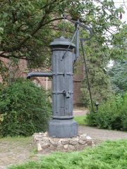
Nl Ge Zeddam. 'De Zwengel' pump. |
|
Region Achterhoek
Nl Ge Terborg. Nr 98 Hoofdstraat, 1891. Current offices of Waterschap Rijn en IJssel, Central Department. NNW 85 1730.
http://www.wrij.nl/ |
|
|
Region Achterhoek
Nl Ge Terborg. Farm on Wisch estate.
http://home.planet.nl/
~graafschap.middeleeuwen/
kastelen/wisch2000.html |
|
Region Achterhoek
Nl Ge Terborg. Huis Wisch. WSW 77 1745.
http://home.planet.nl/
~graafschap.middeleeuwen/
kastelen/wisch2000.html |
|
|
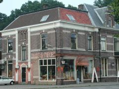
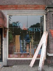
Region Achterhoek
Nl Ge Terborg. Nr 3 Silvoldseweg. Antique furniture and interiors restoration.
http://www.parts-and-pieces.nl/
http://www.belgiumantiques.com/ |
|
Region Achterhoek
Nl Ge Terborg. Nr 3 Silvoldseweg. Antique furniture and interiors restoration.
http://www.parts-and-pieces.nl/
http://www.belgiumantiques.com/ |
|
|
Region Achterhoek
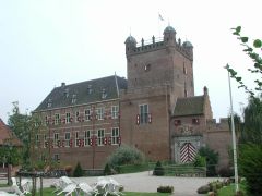
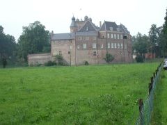
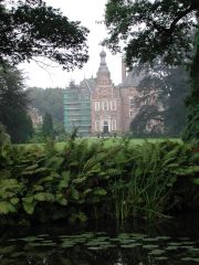
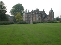
Nl Ge Laag-Keppel. Kasteel Keppel. SSE 85 1845.
http://www.historisch-toerisme-bureau.nl/artikelen/keppel.htm |
|
Region Achterhoek
Nl Ge Laag-Keppel. Kasteel Kepple. Barn on estate. ENE 78 1900. |
|
|
Region Achterhoek
Nl Ge Laag-Keppel. Kasteel Keppel. Outbuilding. SSE. |
|
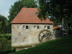
Region Achterhoek
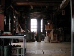
Nl Ge Laag-Keppel. Waterkorenmolen, interior. |
|
|
Region Achterhoek
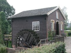
Nl Ge Laag-Keppel. Waterkorenmolen, exterior. NNW. |
|
Region Achterhoek
Nl Ge Laag-Keppel. Standardmolen. ENE. |
|
|
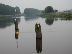
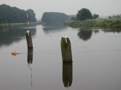
Region Achterhoek
Nl Ge Laag-Keppel. Oude IJssel waterway. With model power-boat. ENE. |
|
Region Achterhoek
Nl Ge Laag-Keppel. Oude IJssel waterway. With model power-boat. ENE. |
|
|
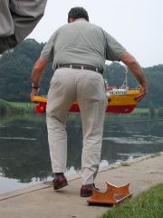
Region Achterhoek
Nl Ge Laag-Keppel. Oude IJssel waterway. Man with model power-boat. |
|
Region Achterhoek
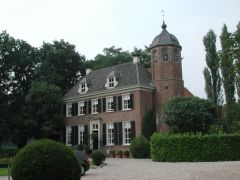
Nl Ge Laag-Keppel. Kasteel Keppel. ENE 77 1930.
http://www.historisch-toerisme-bureau.nl/artikelen/keppel.htm |
|
|
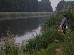
Region Achterhoek
Nl Ge Laag-Keppel. Oude IJssel. Fishermen. |
|
Region Achterhoek
Nl Ge Laag-Keppel. House on the Kasteel Keppel estate. |
|
|
Region Achterhoek
Nl Ge Laag-Keppel. Oude IJssel near Kasteel Keppel. |
|
Region Achterhoek
Nl Ge Laag-Keppel. Farm near Laag-Keppel. |
|
|
Region Achterhoek
Nl Ge Lochem. Twentekanaal near Lochem. WNW 80 2030. |
|
|
|
Wednesday 28 August 2002
DAY Bornerbroek Ov, Eibergen Ge, Ziewent Ge, Varsseveld Ge, Slangenburg Ge, Vorden Ge, Ruurlo Ge
NIGHT Bornerbroek Ov
|
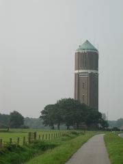
Region Achterhoek
Nl Ge Eibergen. Water tower near Eibergen. SSW 80 1000. |
|
Region Achterhoek
Nl Ge Eibergen. House near Eibergen. |
|
Region Achterhoek
DrivingTour, THE CENTER
Zieuwent, Varsseveld, Hengelo, Vorden, Ruurlo
|
Nl Ge Zieuwent. 1896 Barn. |
|
Nl Ge Zieuwent. House next to St-Werenfriduskerk. WSW. |
|
|
Nl Ge Zieuwent. Sint-Werenfriduskerk (late 19th-cen). 70 m tower. WNW 75 1045. |
|
Nl Ge Varsseveld. Windmolen near Varsseveld. 'Hermien', 1819/1987. In the background is Zieuwent. NNE 78 1100. |
|
|
Nl Ge Varsseveld. 1885 windmolen 'De Encel'. WNW 78 1115. |
|
Nl Ge Varsseveld. The 1885 windmolen 'De Encel' is next to this man's property. In earlier days, his father was the molenaar. |
|
|
Nl Ge Varsseveld. Reformed (Ned Herv/Geref Diensten) church 'Laurentiuskerk', with tower dating from 1300, chor from 1450, nave from 1500. Original structure 1100/1200. ENE 75 1145. |
|
Nl Ge Varsseveld. Reformed (Ned Herv/Geref Diensten) church 'Laurentiuskerk', with tower dating from 1300, chor from 1450, nave from 1500. Original structure 1100/1200. NW. |
|
|
Nl Ge Varsseveld. Reformed (Ned Herv/Geref Diensten) church 'Laurentiuskerk', with tower dating from 1300, chor from 1450, nave from 1500. Original structure 1100/1200. |
|
Nl Ge Doetinchem. 1851 barn in Slangenburg. |
|
|
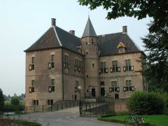
Nl Ge Doetinchem. Kasteel Slangenburg. N 75 1215. |
|
Nl Ge Doetinchem. Kasteel Slangenburg grounds. |
|
CyclingTour, EIGHT CASTLES
Vorden and environs
|
Nl Ge Vorden. Kasteel Hackfort, secondary building. As recently as 1941 there were 41 farms on the estate. Today, 13 are still in use. The first floor of the castle dates from 1788. The noble Hackfort was in residence 1475-1533. |
|
Nl Ge Vorden. Kasteel Hackfort. As recently as 1941 there were 41 farms on the estate. Today, 13 are still in use. The first floor of the castle dates from 1788. The noble Hackfort was in residence 1475-1533. |
|
|
Nl Ge Vorden. Huis den Bramel. The castle, with its double moats, was re-shaped in 1720. The last son of the Bramel line died in 1995. |
|
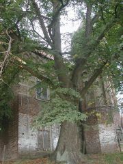
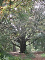
Nl Ge Vorden. Famous old tree. |
|
|
Nl Ge Vorden. Den Wildenborch. Currently owned by the poet Staringh. |
|
Nl Ge Vorden. De Wiersse. |
|
|
Nl Ge Vorden. 't Medler. |
|
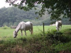
Nl Ge Vorden. Farmlands in the vicinity of 't Medler. |
|
|
Nl Ge Vorden. Het Onstein. |
|
Nl Ge Vorden. Kieftskamp. Built 1776. In 1975 the property was sold to the Geldersch Landschap community. |
|
|
Nl Ge Vorden. Huis te Vorden. The castle is found mentioned as early as 1208. The estate was originally comprised of 60 farms, reduced over the years to three, currently. The first owner of the castle, in the 1500s, was Steven van Vorden. In 1976 the property was obtained by the community of Vorden. |
|
|
|
|
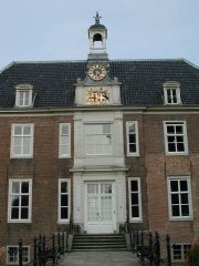
Nl Ge Ruurlo. Kasteel Huize Ruurlo (now Town Hall Gemeentehuis Ruurlo). SSE 83 1800. |
|
Nl Ge Ruurlo. Kasteel Huize Ruurlo (now Town Hall Gemeentehuis Ruurlo). ESE. |
|
|
Nl Ge Ruurlo. Kasteel Huize Ruurlo (now Town Hall Gemeentehuis Ruurlo). ESE. |
|
Nl Ge Ruurlo. Kasteel Huize Ruurlo (now Town Hall Gemeentehuis Ruurlo). NNW. |
|
|
Nl Ge Ruurlo. Kasteel Huize Ruurlo (now Town Hall Gemeentehuis Ruurlo). WNW. |
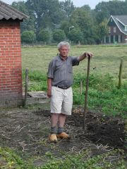
|
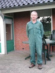
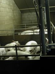
Nl Ge Ruurlo. Mr Jo Westerveld, Nr 10 Haarweg, Ruurlo. 14 hectares, 25 cows 800 pigs. On land once called Farm 'De O', part of the Estate of the Castle Ruurlo. The original farm was called 'De O' from about 1600; no Os have lived on the property since about 1800. Mr Westerveld, 50 years of age, is tired of the hard life; he will sell out and retire. |
|
|
Nl Ge Ruurlo. Mr Jo Westerveld, Nr 10 Haarweg, Ruurlo. 14 hectares, 25 cows 800 pigs. On land once called Farm 'De O', part of the Estate of the Castle Ruurlo. The original farm was called 'De O' from about 1600; no Os have lived on the property since about 1800. Mr Westerveld, 50 years of age, is tired of the hard life; he will sell out and retire. |
|
|
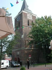
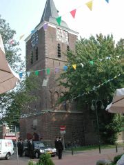
Nl Ge Ruurlo. Church, Parochie St Willibrord. ENE 76 2015. |
|
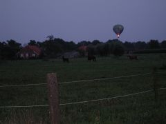
Nl Ge. Farm scene with hot-air balloon, along the drive from Ruurlo Ge, back to Bornerbroek Ov. |
|
RELATED WEBSITES
http://www.gelderlandinbeeld.nl
http://www.kasteleningelderland.nl
http://www.deachterhoek.nl
http://www.hgl-vgk.nl
http://www.wazamar.org/gen-links/aa-nl-prov-gld.htm
http://community.webshots.com/album/25465358zVcrTnkgcw
HISTORY
http://home.planet.nl/~graafschap.middeleeuwen/algemeen/introductie.html
RECREATION & SPORTS
http://members.chello.nl/~a.meijer103/fishingplaces__de_achterhoek__ne.htm
ENTERTAINMENT
http://www.kasteelconcerten.nl
~ End of GELDERLAND ~
~ 265 Images ~
~ Posting completed 15 May 03 ~
|
FRIESLAND The Netherlands |
UTRECHT The Netherlands |
| | |
|
|
|
|
|
|